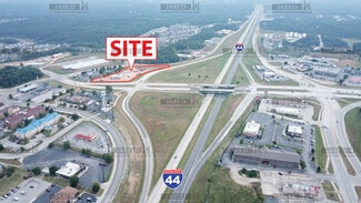
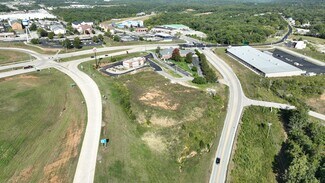
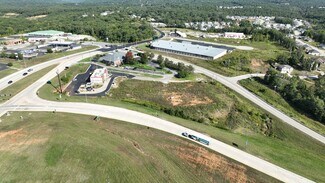
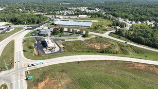
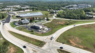
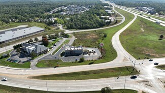
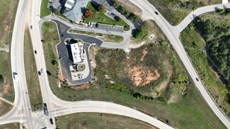
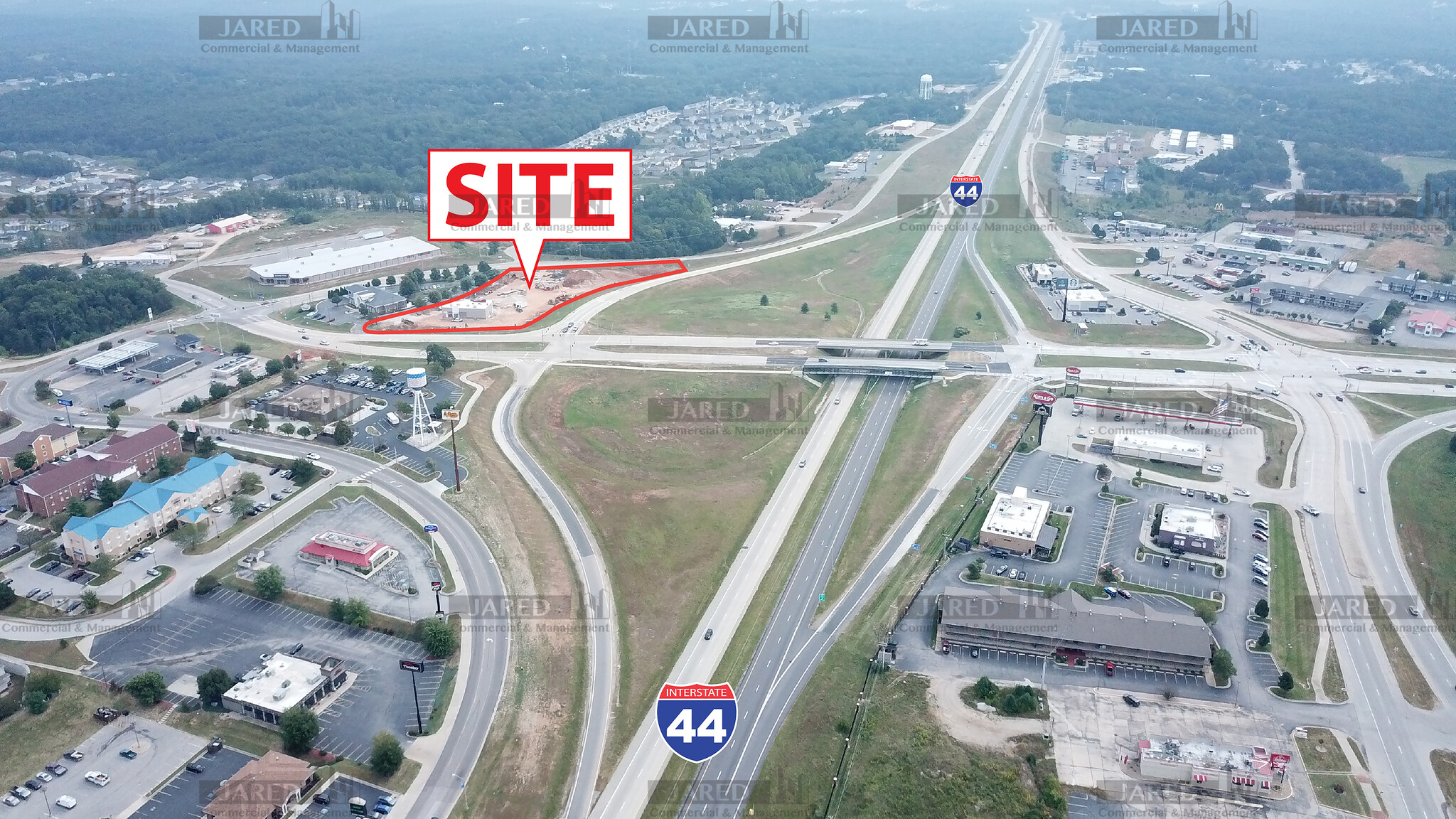
430 STATE HIGHWAY Y - Commercial LAND FOR SALE
St Robert, MO 65584 | 111,949 SF
$2,169,000 USD

417-350-4771
430 STATE HIGHWAY Y
St Robert, MO 65584
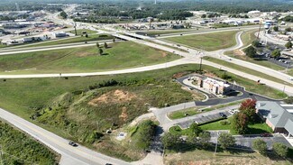
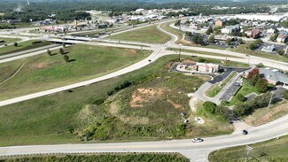
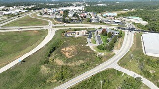
OVERVIEW
All that part of the Northeast quarter of the Northwest quarter of Section 28, Township 36 North, Range 11
West of the Fifth Principal Meridian described as follows: Commencing at the Northeast corner of the
Northeast quarter of the Northwest quarter of said Section 28; thence North 88 degrees 07 minutes 32
seconds West 34.15 feet along the North line of said Northeast quarter of the Northwest quarter to the
intersection of the North boundary line of the U.S. Interstate 44 and the Southerly boundary line of the North
Outer Road, the point of beginning of the hereinafter described tract; thence continuing along said North line,
North 88 degrees 07 minutes 32 seconds West 459.18 feet; thence Southerly 5.21 feet along the arc of a
curve turning to the left with a radius of 371.68 feet, the chord of said curve bears South 14 degrees 44
minutes 46 seconds East 5.21 feet; thence South 15 degrees 14 minutes 30 seconds East 260.11 feet;
thence Easterly 426.44 feet along the arc of a curve turning to the right with a radius of 716.62 feet, the chord
of said curve bears South 86 degrees 53 minutes 10 seconds East 420.18 feet; thence North 00 degrees 49
minutess 42 seconds East 218.38 feet; thence North 35 degrees 55 minutes 08 seconds West 54.81 feet;
thence North 51 degrees 27 minutes 49 seconds West 1.71 feet to the point of beginning.
FOR SALE DETAILS
PRICE
$2,169,000 USD
PRICE/ACRE
$843,970/AC
PRICE/SF
$19 USD /SF
# OF LOTS
-
LAND DETAILS
PROPERTY NAME
430 State Hwy Y
PROPERTY TYPE
Land
PROPERTY SUBTYPE
Commercial
LAND PROPOSED USE
Retail, Auto Repair, Car Wash, Convenience Store, Drug Store, Fast Food, General Freestanding, Restaurant, Strip Center
LAND ACRES
2.57 AC
LAND SF
111,949 SF
OFFSITE IMPROVEMENTS
-
ZONING
Commercial
APN/PARCEL ID
10-8.0-28-001-001-004-000,10-8.0-28-001-001-004-001,10-8.0-28-001-001-004-002
ASK ABOUT THIS PROPERTY
Please correct the highlighted field(s).

417-350-4771
By clicking the button, you agree to Showcase's Terms of Use and Privacy Policy.
Please correct the highlighted field(s).
417-350-4771
By clicking the button, you agree to Showcase's Terms of Use and Privacy Policy.